Why Satellite-Based Solar Design Fails: A Real 13.2 kW Case Study from Turkey
The Project
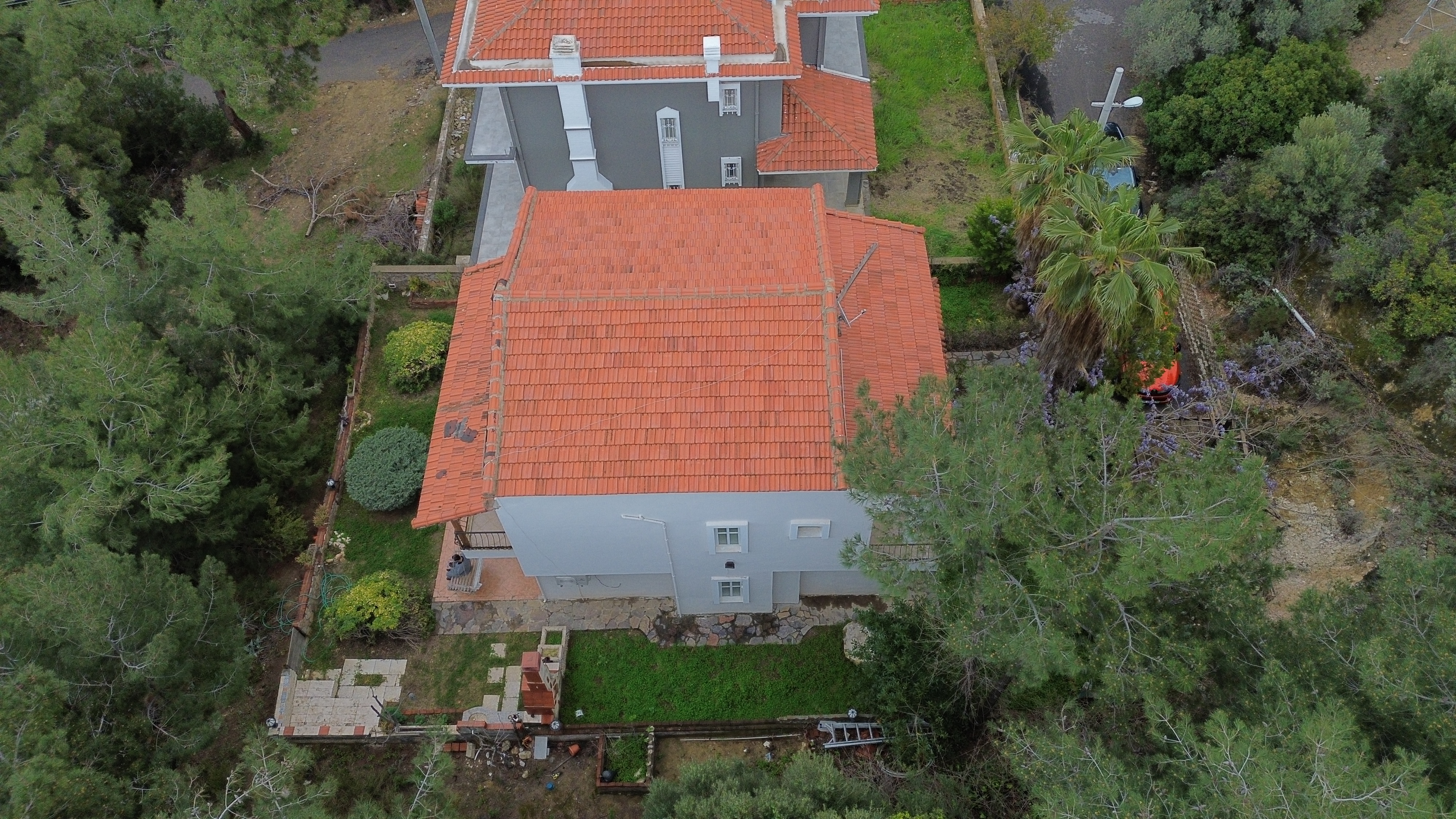
On April 30th, we visited a residential solar project in Çeşme, İzmir to prepare a proposal for a 13.2 kW rooftop solar installation.
At first glance, this might seem like a standard EPC workflow: analyze the site remotely, design the system, and submit a proposal.
However, this project clearly demonstrated a major issue in modern solar project development: satellite-based design is often not reliable enough.
The Problem with Map-Based Solar Design
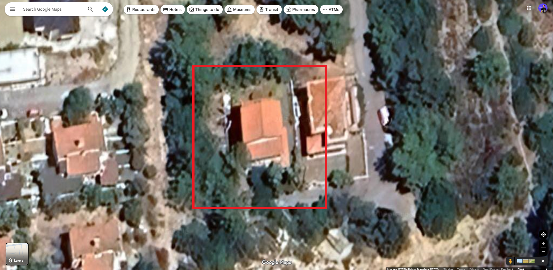
Before visiting the site, we attempted to evaluate the project using satellite imagery.
But several critical limitations quickly became apparent:
- Tree heights were impossible to estimate accurately
- Roof geometry was partially obscured
- Shading risks could not be properly analyzed
This is where many EPC companies make a critical mistake.
They proceed with assumptions.
And in solar engineering, assumptions often lead to:
- Incorrect system sizing
- Unexpected shading losses
- Reduced long-term system performance
- Loss of customer trust
A Different Approach: Drone-Based Site Validation
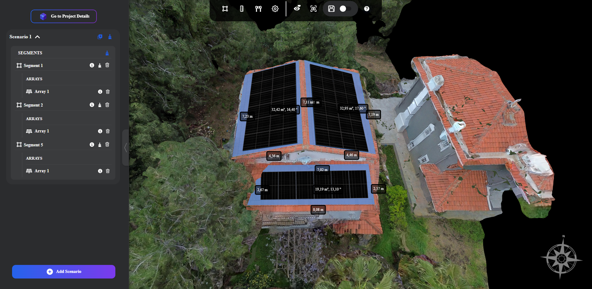
Instead of relying on incomplete data, we decided to validate the site physically.
We conducted a drone survey of the property and processed the data using Render-a 3D modeling platform.
The result?
A complete and accurate 3D model of the site generated in just 13 minutes.
This allowed us to analyze the property with a level of precision that satellite data simply cannot provide.
Critical Insight Discovered
While reviewing the 3D model with the homeowner, we identified a major issue:
A large tree located very close to the southwest-facing section of the roof.
This created two significant risks:
- Seasonal shading, which would reduce solar energy production
- Increased fire risk in a region already prone to wildfires
This issue would have gone completely unnoticed in a map-based design workflow.
From Data to Decision
After identifying the risks, we analyzed the household’s energy consumption and designed an optimized system accordingly.
The result was a properly engineered 13.2 kW solar installation tailored to real-world conditions.
More importantly, the homeowner was able to clearly understand:
- The risks
- The design decisions
- The expected performance
before making an investment.
Download Solar Generation and Feasibility Report Generated By Render-a (PDF)Key Takeaway
In solar EPC projects, validating real-world conditions before design is not optional, t is essential.
Many companies still rely heavily on satellite-based workflows. But the cost of incorrect assumptions often becomes visible too late in the project lifecycle.
Final Thoughts
Drone-based data collection and 3D modeling are not just “nice-to-have” technologies.
They are becoming essential tools for:
- Improving design accuracy
- Reducing project risks
- Building trust with clients
If you are working in solar EPC or project development, I would be interested to hear your experience:
Where do you usually encounter the biggest inaccuracies in your projects?
If you're interested in exploring similar workflows, you can create a demo account and try it for yourself: Render-a